
Table of Contents:
Cyprus Map Europe: The Island’s Exact Position
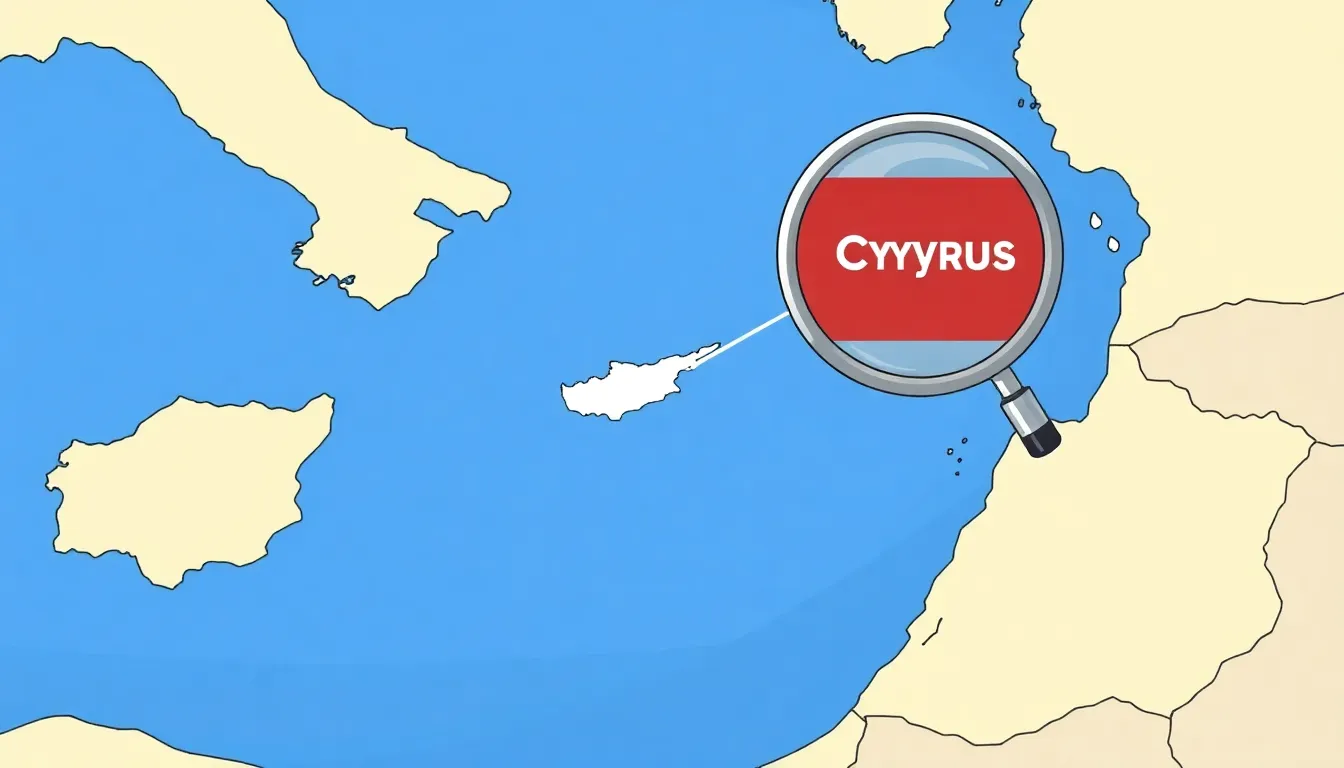
On a Cyprus map Europe view, Cyprus appears in the far eastern Mediterranean, south of Türkiye and west of Syria and Lebanon. It is the third-largest island in the Mediterranean Sea, after Sicily and Sardinia. Its position is easy to miss on a standard Europe map because the island lies far from the continent’s mainland.
Use these coordinates to locate it precisely: Cyprus extends roughly from 34°33′ to 35°41′ north and from 32°16′ to 34°37′ east. The island is about 240 kilometres west of the Syrian coast and around 75 kilometres south of Türkiye’s southern shore. Greece lies farther west; the Greek island of Kastellorizo is the nearest Greek territory.
- North: Türkiye and the Kyrenia mountain range
- East: the Levantine Basin and the coast of Syria
- South: the open Mediterranean Sea
- West: the wider Mediterranean, toward Crete and mainland Greece
On a classroom map of Europe with Cyprus highlighted, the island is usually marked near the lower-right edge of the European region. This placement shows its geographical setting, not a direct land connection. Cyprus has no land border with another country. The closest mainland coast is Türkiye, while Egypt is about 380 kilometres to the south.
Geographically, Cyprus sits at the meeting point of Europe, Asia and the Middle East; politically, the Republic of Cyprus is a European Union member state. Both facts can be true at once. Map scale also matters: on a full Europe map, Cyprus may appear as a small dot, so a regional inset of the eastern Mediterranean gives a much clearer picture.
Cyprus in the Eastern Mediterranean Between Europe and Asia
Cyprus occupies a space where southern Europe, the eastern Mediterranean and the Middle East meet. This makes its position on a cyprus map europe image more complex than a simple east–west label. The island is part of the Mediterranean world, yet its links reach toward both European and Asian shores.
Geographers often place Cyprus in the Levantine Basin, the eastern section of the Mediterranean Sea. This basin connects the island with the coastlines of Türkiye, Syria, Lebanon and Israel. The sea has shaped trade routes, migration, naval power and cultural exchange for thousands of years.
Cyprus also forms a useful bridge between nearby landmasses:
- It faces the Anatolian Peninsula to the north.
- It looks toward the Levantine coast to the east.
- It lies within reach of North Africa across the southern Mediterranean.
- Its cultural and historical ties also connect it with the Aegean and wider Greek world.
That mixture explains why maps can classify the island in different ways. A physical map may place Cyprus beside West Asia because of its location and nearby coastlines. A political map of Europe may include it among European states because of its constitutional and institutional links. Neither view replaces the other; each answers a different question.
For students reading a map of Europe with Cyprus highlighted, the key lesson is that geographical regions overlap. Europe has no single edge accepted for every purpose, especially in the eastern Mediterranean. Cyprus is therefore best understood as an island at a regional crossroads rather than as a landmass that fits neatly inside one continental box.
This location gives the island strategic importance beyond its modest size. Its ports and air routes sit near major connections between Europe, the Suez route and the eastern Mediterranean. On a broad Europe map, Cyprus may look peripheral; for understanding movement across this part of the world, its position is central.
Cyprus: Location, Surrounding Regions and Political Status
| Aspect | Relevant Information |
|---|---|
| Geographical region | Eastern Mediterranean, at the meeting point of Europe, Asia and the Middle East |
| Coordinates | Approximately 34°33′–35°41′ north and 32°16′–34°37′ east |
| Position relative to Türkiye | About 75 kilometres south of Türkiye’s southern coast |
| Position relative to Syria | Approximately 240 kilometres west of the Syrian coast |
| Nearest Greek territory | Kastellorizo, located west of Cyprus |
| Surrounding sea | The Mediterranean Sea, particularly the Levantine Basin |
| Land borders | Cyprus has no land border with another country |
| Political status | The Republic of Cyprus is a member of the European Union |
| EU membership | Cyprus joined the European Union on 1 May 2004 |
| Capital | Nicosia, located near the centre of the island |
| Map appearance | Usually shown near the lower-right edge of a map of Europe, separated from the mainland by sea |
| Island size ranking | Third-largest island in the Mediterranean Sea, after Sicily and Sardinia |
How to Find Cyprus on a Map of Europe
To find Cyprus on a cyprus map europe image, begin with the eastern Mediterranean rather than the European mainland. Move east from Greece across the Aegean Sea, then look below the southern coast of Türkiye. The island is often shown near the lower-right corner of a standard Europe map, where its small outline can be easy to overlook.
A reliable map-reading method is to use a sequence of reference points:
- Identify Greece and the Aegean Sea.
- Trace the map east toward the Anatolian coast.
- Look south of Türkiye for the large island shaped somewhat like an irregular diamond.
- Check the eastern Mediterranean label to confirm the location.
Do not use the map’s visual size as a guide. Many classroom maps compress the eastern Mediterranean, while world maps may reduce Cyprus to a tiny mark. A regional inset gives the clearest result. On a map of Europe with Cyprus highlighted, the island should stand apart from the mainland and appear well below the Balkans.
For a quick visual check, search for the island’s long west–east axis. The western end points toward the open Mediterranean, while the narrow northeastern extension reaches toward the coast of Türkiye. This distinctive outline helps separate Cyprus from Crete, Rhodes and other Aegean islands.
Political maps add another clue: Cyprus is normally coloured with European Union countries, even though it is separated from them by sea. A physical map, by contrast, focuses on coastlines, relief and ocean basins. Compare the map title and legend first; they indicate whether the image explains geography, politics or both.
When using a digital map, zoom out until Greece, Türkiye and the Levant are visible together. At that scale, Cyprus becomes easier to place in its regional setting. Zooming in afterwards reveals cities, roads and the island’s internal boundary lines.
Cyprus’s Nearby Countries and Seas
On a cyprus map europe view, Cyprus is surrounded by several distinct maritime regions rather than land borders. Its nearest mainland neighbour is Türkiye, while the coastlines of Syria and Lebanon lie to the east. Israel is farther south-east, and Egypt sits across the open water to the south.
The island is washed by the Mediterranean Sea. More precisely, maps often place it within the Levantine Basin, the easternmost part of that sea. Some atlases also label the water immediately north of Cyprus as the Cilician Sea and the area south of the island as the Levantine Sea. These names describe local sections of one connected marine system.
- North: the sea between Cyprus and Türkiye, often called the Cilician Sea
- East: the Levantine Basin, facing Syria and Lebanon
- South: the broad Levantine Sea toward Egypt
- West: the open Mediterranean leading toward Crete and the Aegean
Cyprus has no land frontier. Its political neighbours are therefore separated by water, a detail that matters when reading a map of Europe with Cyprus highlighted. The shortest maritime approach is toward Türkiye, but the island also sits close to major routes linking the Aegean, the Suez Canal and the Middle East.
Three capes help identify the coastline. Cape Arnaoutis marks the western tip, Cape Greco projects from the south-east, and Cape Kormakitis extends from the north-west. Together, they make the island’s angled outline easier to recognise on a detailed map.
The northern coast is more rugged, with the Kyrenia range running close to the shore. The southern side opens toward wide stretches of the Mediterranean. This contrast gives a physical map useful depth: Cyprus is not merely a highlighted shape, but a strategically placed island between several maritime corridors.
Why Cyprus Is Politically Part of Europe
Cyprus is politically European because the Republic of Cyprus has been a member of the European Union since 1 May 2004. EU membership followed negotiations based on democratic institutions, the rule of law, human rights and a functioning market economy. These legal and political ties matter more than the island’s position on a physical map.
On a cyprus map europe graphic, this status is usually shown through the same colour used for other EU countries. The symbol identifies the state’s participation in a shared political system; it does not claim that Cyprus is attached to the European mainland.
EU membership gives Cyprus defined rights and duties. Its citizens are EU citizens, and the country takes part in EU decision-making, the single market and common policies. Cyprus also uses the euro, which links its financial system to the euro area.
The island’s constitutional situation requires a careful distinction. The whole island is legally part of the EU, but EU law is suspended in areas where the government of the Republic of Cyprus does not exercise effective control. This arrangement reflects the island’s division without removing Cyprus from the Union.
- Cyprus elects representatives to the European Parliament.
- Its government takes part in the Council of the European Union.
- Cypriot citizens hold EU citizenship.
- EU rules apply fully in the areas controlled by the Republic of Cyprus.
Continental geography and political belonging use different criteria. A map of Europe with Cyprus highlighted therefore presents a political relationship, not a land bridge. The island is European in law and institutions, while its physical setting remains eastern Mediterranean.
Cyprus as an EU Member State
Cyprus is an EU member state with a distinct role in European decision-making. Its accession on 1 May 2004 placed the Republic of Cyprus within the Union’s legal and political framework during the major enlargement toward Central and Eastern Europe.
Its membership is visible on a cyprus map europe illustration through the same EU classification used for other member states. The map shows political participation, not physical proximity. Cyprus remains separated from every other EU country by sea.
The island adopted the euro on 1 January 2008. This places Cyprus inside the euro area and connects its monetary policy to the European Central Bank. It is not yet part of the Schengen Area; accession requires further technical and legal alignment.
- Cyprus has six members in the European Parliament.
- Cypriot ministers join the Council of the European Union when national policy areas are discussed.
- The country can hold the rotating presidency of the Council for six months.
- Its citizens have the rights and duties of EU citizenship.
EU membership also creates a legal distinction across the island. The entire territory is considered EU territory, but the application of EU law is suspended in areas outside the effective control of the Republic of Cyprus. This arrangement does not create a separate EU membership for the north.
For a map of Europe with Cyprus highlighted, the most accurate caption combines geography and law: Cyprus is an island in the eastern Mediterranean and a member state of the European Union. That wording avoids treating political Europe and physical Europe as identical.
Nicosia and Key Places to Locate on the Map
Nicosia sits near the centre of Cyprus and is the island’s main political and administrative reference point. On a detailed cyprus map europe, it helps orientate the viewer between the western, southern and eastern districts. The city is divided by the UN buffer zone, which runs through the urban area and makes Nicosia a distinctive place to study on a political map.
Start with Nicosia, then trace the island’s main coastal cities. Their positions show how Cyprus is organised around a compact interior and several important ports:
- Limassol: on the southern coast, it is a major port and the island’s second-largest city.
- Larnaca: on the south-east coast, it is known for its airport, harbour and salt lake.
- Paphos: on the south-west coast, it marks the island’s western urban centre.
- Famagusta: on the east coast, it is a historic port city in the north-eastern part of the island.
- Kyrenia: on the northern coast, it lies below the Kyrenia mountain range and is noted for its harbour.
Several natural landmarks sharpen the map image. The Troodos Mountains occupy much of the south-western interior, with Mount Olympus as their highest point. The Kyrenia range forms a narrow arc along the north. Between these mountain zones, the Mesaoria plain stretches across the central part of the island and leads toward Nicosia.
For a map of Europe with Cyprus highlighted, these places add scale and direction. Paphos and Kyrenia mark opposite coastal sides, while Larnaca and Famagusta point toward the eastern end. Nicosia, set inland between them, explains why the capital is not a seaport.
The Cyprus Map Europe View: Geography and Scale
A cyprus map europe image can change the way Cyprus looks simply by changing its scale. On a continental map, the island may appear as a small mark near the edge of the frame. On a regional map, its coastline, mountains and towns become far easier to read. Its apparent size is therefore a design effect, not a measure of its importance.
Scale means the relationship between a distance on paper and the real distance on Earth. A map at 1:10,000,000 shows a much wider area than one at 1:1,000,000, but it displays fewer local details. This distinction matters when comparing a Europe map with a regional map of Cyprus and the eastern Mediterranean.
- Small-scale map: shows Europe, nearby seas and broad political patterns.
- Medium-scale map: shows Cyprus alongside surrounding coasts and major islands.
- Large-scale map: shows roads, settlements, relief and local boundaries.
Projection also affects the visual result. Flat maps represent a curved Earth, so shape, distance or area may be slightly distorted. A projection designed for Europe can make Cyprus look stretched or displaced compared with a local chart. The map’s legend, scale bar and projection note should be checked before drawing conclusions.
Colour provides another layer of meaning. In a map of Europe with Cyprus highlighted, a bright island usually signals a political category. Blue shading may instead indicate water depth, while brown or green tones often show elevation. A clear legend prevents these symbols from being mixed up.
For classroom use, the most informative layout combines two panels: a wide Europe map for regional context and a larger eastern Mediterranean inset for detail. This paired view lets readers understand both Cyprus’s position and its physical features without forcing one map to do two different jobs.
Cyprus’s Division and Its Position on the Map
The island has been divided since 1974, after a coup supported by the Greek military junta and the subsequent Turkish military intervention. A United Nations buffer zone, known as the Green Line, now crosses Cyprus from west to east. It separates the areas administered by the Republic of Cyprus from the northern part of the island.
The north is administered by the self-declared Turkish Republic of Northern Cyprus, recognised only by Türkiye. The Republic of Cyprus and the international community do not recognise it as a separate state. This distinction is essential when reading a cyprus map europe: a map may show two administrations, but it should not imply two widely recognised countries.
The Green Line is not a normal international border. It is a UN-monitored separation zone. Crossing points allow movement between the two sides, subject to current rules and document checks. The capital, Nicosia, is divided by this line, making it one of the few European capitals with a UN buffer zone running through its urban area.
Cartographers use different symbols to explain the situation:
- A solid boundary may show the internationally recognised territory of the Republic of Cyprus.
- A shaded strip may identify the UN buffer zone.
- A dotted or differently coloured line may mark the ceasefire line.
- A note may explain that the northern area is not recognised as a separate sovereign state by most countries.
On a map of Europe with Cyprus highlighted, the entire island may be coloured as EU territory. However, EU law is suspended in the areas where the Republic of Cyprus does not exercise effective control. Political status, administrative control and map colouring are related, but they are not identical.
For accurate study, check the map legend and publication date. Boundary symbols can vary, and political maps may simplify a sensitive reality. The clearest map presents the Green Line, the buffer zone and the island’s internationally recognised status without treating the division as a settled international frontier.
Example: Reading a Europe Map with Cyprus Highlighted
Imagine a political map of Europe that uses one bright colour for Cyprus and a neutral shade for the surrounding seas. The first task is not to judge the island’s size, but to read the map’s visual code. Locate the highlighted shape, then compare it with the legend, title and date of publication.
On this cyprus map europe example, the highlight identifies a country rather than a geographic region. The map may also use a star for the capital, thin lines for internal divisions and a shaded strip for the UN buffer zone. Each symbol carries a separate meaning, so the legend should be read before interpreting boundaries.
A useful classroom reading sequence is:
- Read the title to identify the map’s purpose.
- Check the legend for colours, lines and symbols.
- Find the highlighted island without estimating political status from its position alone.
- Compare the island with nearby countries and major seas.
- Read the source and publication date, especially for political boundaries.
Suppose the map colours all EU member states blue and Cyprus yellow. The contrast tells you that Cyprus belongs to the same political group, while the sea around it explains its physical separation. If a second outline appears across the island, it may represent an administrative division rather than an internationally recognised border.
The map can also reveal omissions. A small-scale Europe map may leave out towns, mountain ranges and minor islands. That does not mean they are unimportant; the cartographer has reduced detail to keep the wider pattern readable. An inset map is often added when the highlighted country needs closer inspection.
For a strong social-studies answer, describe both layers: Cyprus is shown as a European political entity, yet its physical location is in the eastern Mediterranean. This wording explains what the map communicates without confusing colour, geography and sovereignty.
Fazit: Use the Cyprus Map Europe Location as Your Guide
A cyprus map europe image is most useful when you treat it as a layered guide. First, it shows the island’s place within the eastern Mediterranean. Then, political colouring explains its connection to Europe. Together, these layers answer the question more accurately than either a physical or political map alone.
For study, travel planning or social-science work, choose a map with a clear legend, a visible scale bar and a recent publication date. If the island’s division matters, use a map that identifies the UN buffer zone and explains its symbols. A bright highlight without context can look striking, but it may leave the reader guessing.
- Use a Europe map to understand Cyprus’s wider regional setting.
- Use an eastern Mediterranean inset to read nearby coastlines and sea areas.
- Use a political map to identify EU membership and administrative lines.
- Use a physical map to examine relief, capes and mountain ranges.
The strongest map of Europe with Cyprus highlighted does not force geography and politics into one simple answer. It shows where the island lies, how it is connected to European institutions and why its location has lasting strategic value. Borders, regions and political communities do not always share the same outline.
For a dependable final check, compare the visual map with official information from the European Union country profile for Cyprus and the United Nations Peacekeeping Force in Cyprus. The map gives the spatial answer; these institutional sources clarify the legal and political one.
Frequently Asked Questions About Cyprus on the Map of Europe
Where is Cyprus located on the map of Europe?
Cyprus is located in the eastern Mediterranean Sea, south of Türkiye and west of Syria and Lebanon. On a cyprus map europe view, it appears near the southeastern edge of Europe.
Is Cyprus part of Europe or Asia?
Geographically, Cyprus lies at the crossroads of Europe, Asia and the Middle East. Politically, the Republic of Cyprus is a European Union member state, so it is commonly shown as part of political Europe.
Is Cyprus a member of the European Union?
Yes. Cyprus joined the European Union on 1 May 2004. Its citizens are EU citizens, and the country participates in EU institutions. Cyprus adopted the euro on 1 January 2008.
Which countries are closest to Cyprus?
Türkiye is the closest mainland country to Cyprus, located north of the island. Syria and Lebanon lie to the east, Israel to the southeast and Egypt farther south across the Mediterranean Sea.
How can I find Cyprus on a Europe map?
Start by locating Greece and Türkiye. Move east across the Mediterranean and look south of Türkiye for the island of Cyprus. On a map of Europe with Cyprus highlighted, it is usually shown near the lower-right edge of the map.